Frequently Asked Questions

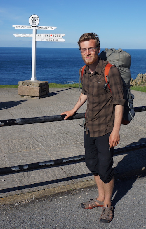
Along the way, and afterwards I had many conversations about my walk from John o’Groats to Land’s End, and many questions. Here are a few of the question that come up most often…


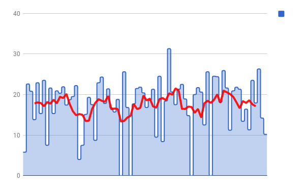
How many miles did you walk each day?

About 18 miles a day on average, but it varied a lot. Some days I’d walk 25, others 15. Occasionally even less or even more.

I had a total of 6 rest days, though I climbed the UK’s highest mountain on one of those rest days so perhaps only five really!

Over the whole journey, I kept a fairly steady pace on average. I felt fitter towards the end, and it got easier, but I didn’t walk any further – instead I relaxed a bit, and the walking felt more sustainable.

Distance per day over the 74 days of my journey. The red line is a moving average.

Which charity were you doing it for?

I don’t see a connection between walking and a charity. I walk because I enjoy walking. I challenge myself because I enjoy challenging myself. Perhaps it’s a selfish approach, I don’t know. If you feel I should have done it in aid of a charity, well, I’d encourage you to use this as a trigger to make a donation to a deserving charity right now!

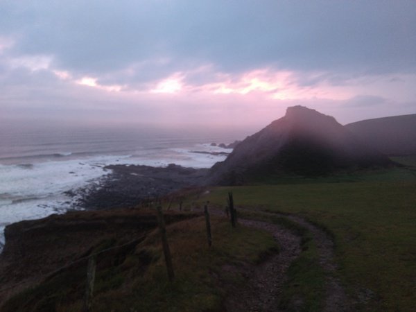
Did you feel lonely walking by yourself?

Not much. I found during the first three weeks when I was in the far north of Scotland, although I barely encountered anyone, I didn’t get lonely. I was however very pleased on the rare occasions that I bumped into someone, so ended up chatting to people I’d never usually stop to chat to, like old anglers.

Hostels were a fantastic way to get some social contact. I met many interesting and friendly people in hostel kitchens, lounges, and dorm rooms. However, it did get slightly weird after a while, because all the friends I made for an evening, I’d leave behind the next day. This is fine for a weekend away, but over a period of 10 weeks it is a bit strange and I found I started to tire of having the same conversations with different people every day.

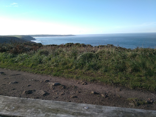
I did sometimes feel lonely when I arrived in towns, when there were people all around, but I didn’t know anyone and wasn’t talking to anyone. I guess that was me being a social animal, feeling I should be talking to people because others were. But I was content being alone out in nature.

So it must have been a wonderful, blissful, meditative experience?

I think I went into it expecting this, but usually this was not the case! When a city-dweller such as myself goes on a day walk, it often is a blissful experience, because the walking is fairly easy and survival is not difficult – just walk for a few hours in nature and then go back to home comforts. But on a multi-day walk, with an ambitious schedule, it was often too tough to be meditative.

There were a lot of practical things to focus on – navigating, setting up camp or packing up, managing my food, booking accommodation, etc. Then there was pain to put up with. Early on I had a few blisters, my legs ached, and my back too. The pain lessened over time as I switched to walking sandals, made my pack lighter, my legs adapted, and I got away from the Scottish midges. But it was physically challenging all the way through, so it usually wasn’t the blissful experience that easier day walks can be. There were moments though!

Did you ever want to give up?

Yes, certainly! I wanted a few days in after wading through the Moss of Killimster. But I would have been too ashamed!

One month in, as I came towards the English border, I felt I had already achieved a lot, having walked the length of Scotland, but I was physically exhausted and mentally bored. I had the idea of going back home to rest, and give my brain something to do (a nice computer programming project perhaps), then continuing the walk another time. Perhaps completing it in three sections. But with the encouragement of friends and family I persevered to complete it all in once go.

Any more questions?

Ask me in the comments below!

The End (2nd October 2016)

The final few hours of walking was blissful, knowing that this would be the day I completed my journey.

Sunday 2nd October 2016

Through abandoned tin mines, notices a few car/van campers. Then stopped near Cape Cornwall / St Just in view of Land’s End.

In view of Land’s End

Walked along beach to Sennon Cove, then up to Land’s End complex, which is a bit of an anti-climax.

The Land’s End complex is a strange place. Most people drive there, and it feels very commercial. It has elements of a theme park.

Bus to Penzance, train to Bristol, then stayed at YHA before back to Chester next day.

Distance: 10.2 miles [view on map]

Due to the bizarre ticket pricing on British trains, it was significantly cheaper to stay overnight in Bristol than get a direct train the same day!

This was the end of my walk, and my journal, but it is not the end of my blog. I expect to share a few more thoughts soon.

Made it!

Lighthouse (1st October 2016)

I started October in the picturesque town of St Ives, with the possibility of finishing the journey that day.

Don’t feed those greedy St Ives seals!

Saturday 1st October 2016

Back into the wilderness – cold and windy walking, but stopped at Zennor for lunch.

Continued on, but it was getting dark so stopped earlier than I wanted, by a lighthouse, with tin mines in the distance.

Distance: 14.2 miles


Covert wild camping near Pendeen Watch lighthouse

I submitted this photo and a short story to a Guardian newspaper assignment on wild camping:

It was cold and windy but the stars were out, the waves were crashing soothingly below, and it got warm quickly enough in my bivi bag.

It made little sense to continue onto Land’s End at this time. Better to save it for the next day then have time to plan a journey home.


Cornish coastal marathon (30th September 2016)

By this point the South West peninsula seemed to never end, and I wanted to make some serious progress.

Friday 30th September 2016

Walked past old airfield then down to tin mine, then through St Agnes. Walked along beach to Porthtowan then along to Portreath.

As usual, almost everyone else was walking in a northerly direction

Continued, skipping Godrery Point down to sand dunes (Towans).

I had come to a fairly urban section, so the best option was now to push on to St Ives where I could stay cheaply at a hostel. I called ahead and found they had plenty of space.

Although I could see St Ives not far off over the bay, it was actually still a long distance to walk because I had to walk to a bridge over the River Hayle.

Then around River Hayle estuary. Approaching Carbis Bay there seemed to be a real micro-climate.

The plants were different here – more tropical. Unlike most of the north Cornish coast, Carbis Bay and St Ives are sheltered from the winds and waves of the Atlantic Ocean.

Carbis Bay

Finally into St Ives and checked into hostel.

Distance: 26.3 miles [view on map]

The sunglasses I set out with had broken, but I found these new ones

Sand (29th September 2016)

Thursday 29th September 2016

Walked down and stopped in Newquay for lunch, tasty flat bread with veg. Onward, past Ministry of Defence camp where I saw a slowworm.

Slowworm

Then over dunes, walked on beach where possible into Perranporth. Found house that I think was B&B we [family] stayed at years ago. Stayed at YHA on clifftops – it used to be a secret military experiment building!

Distance: 17.9 miles [view on map]

Approaching Perranporth

Camel (28th September 2016)

One of the rules of walking John o’Groats to Land’s End is that you do walk – which means not even a quick ferry across a river. And since I didn’t want to wade through the River Camel, I therefore had to skip a few miles of the coastal path to cross the bridge in Wadebridge. Before the bridge was built in the 15th century, the settlement was known as Wade and I would indeed have had to wade through the river, or else my diversion would have been much longer!

Wednesday 28th September 2016

Into Port Issac, bought my first Cornish Pasty. Then over farmland to Wadebridge – difficult to follow with 1:50k map. Stopped in cafe for lunch. Tried ice cream + espresso (affogato).

Next along Camel Estuary to Padstow, then cut across to Trevone on roads, then again to Porthcothan. Set up camp in the dark – others had clearly used the same spot. It was very low, luckily tide did not rise to that level.

Distance: 23.5 miles [view on map]

The Old Bridge, Wadebridge

Tintagel (27th September 2016)

Tuesday 27th September 2016

The weather continued to be dreary, and the walking tough. Stopped at Tintagel for long break in pub.

Tintagel is tourist central. It has a ruined castle with spurious links to King Arthur, an old post office, and lots of tourist shops. I found it quite dull.

Continued on then set up camp in a haven close to Port Isaac.

Distance: 11.3 miles [view on map: part 1, part 2]

Tintagel Castle. Photo © Alan Simkins (cc-by-sa/2.0)

Up and down (26th September 2016)

Continuing on the Cornish coast from Bude…

Monday 26th September 2016

Up to Morrison’s cafe for breakfast, left late in pouring rain (predicted for all day). Rain was not as constant as expected, but walking very hard due to ups and downs.

Arrived in dark at Boscastle, mostly dry but it was very windy! Shop was shut so ate snacks and went to pub for a pint – it had a pirate-y feel!

Distance: 16.4 miles [view on map]

The YHA hostel in Boscastle was fully repaired and refurbished after a 2004 flood which destroyed many of the surrounding buildings.

Cream tea (25th September 2016)

After only three days I was leaving Devon for the final county of my walk.

Sunday 25th September 2016

Continued almost directly south down the coast, before long entering Cornwall. Stopped at farmhouse tearooms for lunch. Had a Cornish Yarg ploughman’s followed by cream tea (2 scones) and was quite satisfied.

My reward for reaching Cornwall

Onwards past a military signal station. Finally into Bude and went to hostel without booking, but it was almost empty anyway. Couldn’t find an open shop so had an Indian.

Distance: 13.4 miles [view on map]

I didn’t cover much distance, but there was a lot of up and down.

The Cornish coast north of Bude

Devon coast (24th September 2016)

Waking up by the sea for the first time since the beginning of my journey over two months before, I was now on the final stretch.

Saturday 24th September 2016

Walked along coast, with Clovelly in sight. Lots of ups and downs. Near Clovelly I was asked “How much further does this go?” and had to disappoint the couple who thought they had gained access by paying the Closely gate fee. I stopped for lunch by the Clovelly bay, then struggled back up and onwards.

The path was fairly flat onto Hartland Point, then more up and down, but also spectacular scenery.

The weather was harsh, the waves crashing into the rocks, but I couldn’t help but be stunned.

Near Hartland Point

There were some fantastic wild camping spots but weather was terrible so I went to Elmscott Bunkhouse for a surprise stay.

Distance: 21.3 miles [view on map]

I wasn’t able to inform the bunkhouse prior to my arrival as I had no phone signal most of the day, and even if I had the rain was so heavy. When I came in, dripping wet, trying to escape the downpour, they even gave me a beer to help me get comfortable!