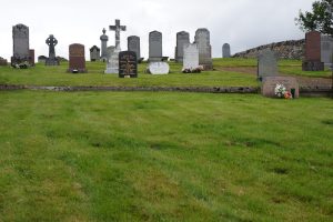
Awoke to fewer midges, discovered that using roll-on [midge repellent] on the tent helps to dispel them. Started with walk down to Kinbrace – boggy again. Passed Network Rail vehicles on road – a nod of the head to one driver was the most interaction I had all day. After passing station, I stopped in a graveyard for shelter to cook lunch.
Crossing the railway line here felt like my first milestone on the walk. I had stopped at Kinbrace station on the train north to Thurso. I felt a bit closer to civilisation – if necessary I could have been in Inverness within a few hours. However, Kinbrace still felt incredibly remote – although there had apparently been a Post Office once, that seemed to have shut now.
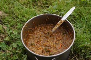
Lunch was my typical curry from dried ingredients. Tasty but difficult to cook on the hills in the presence of midges!Kinbrace cemeteryGravestones in Kinbrace cemetery
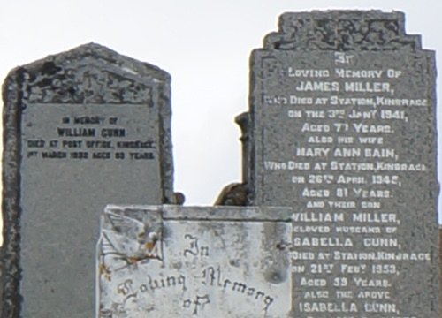
Many of the same surnames were on graves – real locals? “Died at Post Office”, “Died at station” – did they go there to die [or just happened to be there]? Feeling re-energised, I ignored guidebook and took road. This turned into an estate access road, so long that “the post office is not obliged to deliver daily”. Finished with lovely walk along Loch Choire and found pleasant bothy.
The hills around the estate road were fantastic. They still had something of the Flow Country about them, but my feet were quite enjoying the dry access road. Loch Choire was a real gem – one side of the Loch being typically boggy Flow Country, and the other rockier with trees – more typical of the highlands.
I arrived at the bothy after 10pm. I had never stayed in a bothy before. I had read about this one in my guidebook but was not entirely sure it would still be there and be open, but luckily it was so I didn’t have to pitch a tent. It was a cosy little hut equipped with benches to sleep on and a wood burner which I was able to cook on.
Awoke to approx 5000 midges. Packing up was difficult.
A man may dream of waking up to find thousands of females want a piece of him, but when this actually happened to me it was really annoying and quite scary. Only the females of the midge species bite.
A 4×4 passed by – only person encountered all day. Cooked instant potato plus flavourings.
Continued up track along River Thurso, then Glutt Water. Stopped in comfy cabin in the hills (with sauna-like qualities). Collected water from Glutt near iron springs (Chalybeate) – delicious (could taste iron).
This was really tasty – I might go back someday just to taste the water again!
Clouds came down, and I lost sense of direction in the peat morass. Started using compass. GPS also helped a lot to confirm distances.
This was quite a scary experience. I found as I was walking in what I thought was a straight line, I was actually walking in circles. This was boggy ground, and although it was the top of Knockfin Heights, and at some point there was an Ordinance Survey trig point column at one point, there was really no obvious peak. It was just a big flat bog with a number of “lochans” (small lakes) that happened to be at the top of a hill. Once I got the compass out I made slow progress and eventually found the way through the bog to the stream I was looking for. This was the first time I ever really needed a compass – the kind of navigation that I wasn’t able to practice near London.
Came down stream and stopped to camp around ruins of Knockfin.
After recovering from wading through the Moss of Killimster I was able to make good progress after a night’s recovery and a good breakfast at The Brown Trout in Watten.
Saturday 23rd July 2016
Started with porridge and a cooked breakfast, plus copious amounts of juice and coffee. Posted my camera lens home, gave away [most of] my Gorilla Tape. Left a little after 11am.
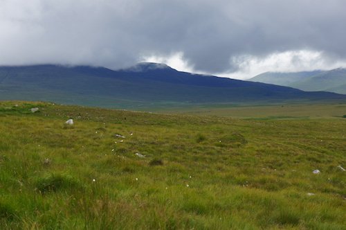
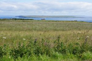
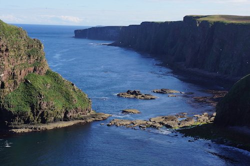
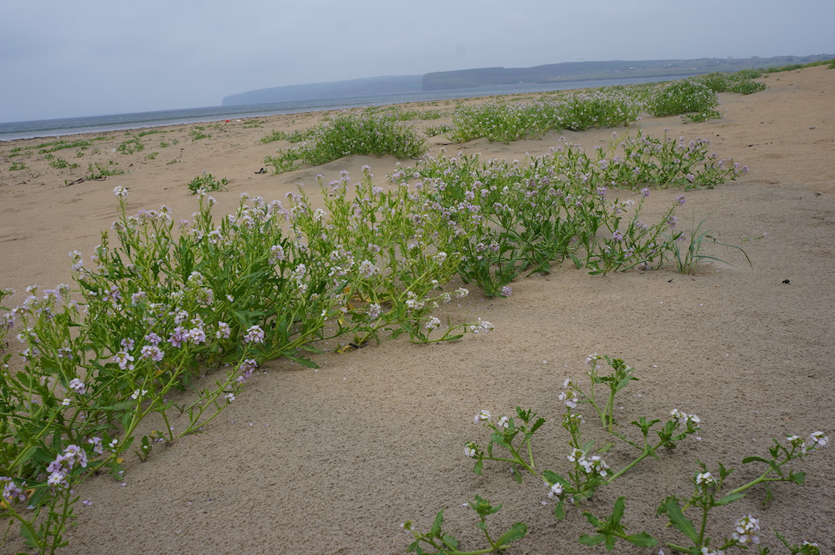
First I was walking through meadows and country lanes, then a forest. At the A9, a fantastic view over the Flow Country – but also realising I had to cross this vast expanse.
Typical Flow Country
“The Flow Country” is the landscape in the far north of Scotland (Caithness and Sutherland). It is an area of blanket bog – which basically means not just boggy patches but bog everywhere – as if the majority of the land is under water. Dry land is a rarity. However, the landscape can be quite beautiful and it apparently plays a role in preventing climate change since the bogs capture carbon.
Then struggled to cross a stream. The author gave 3 alternatives and I had to use the last resort. Realised author will do all he can to avoid roads, even pleasant country lanes, so I will be skeptical.
The author I was referring to was Andy Robinson, author of my guidebook The End to End Trail. After my experience on the Moss of Killimster the previous day I was a bit frustrated by the approach of avoiding road walking at any cost. Today’s difficult scenario was caused by a river I could not cross. If I had been following the guide book in the right direction I would simply have walked further until I reached the bridge, but since I was following it backwards, I had to double back on myself when I found the river to be impassable.
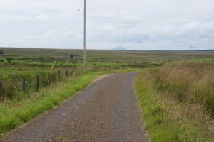
Lots of road walking, then a late night by the River Thurso next to abandoned cottage.
From Keiss Castle I followed the coast south, then headed inland.
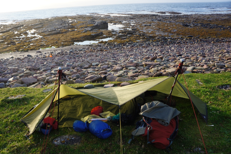
I had set my tarp up to protect me from a harsh wind that had been coming in from the sea at night
Friday 22nd July 2016
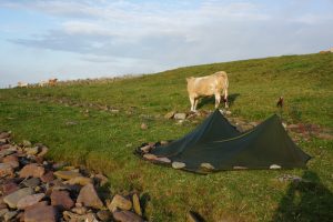
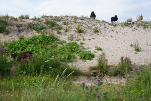
I was woken early by a procession of cows. They were typically curious, one even came down to see me, appearing behind me like a ninja as I packed my stuff up. I started walking along the shore, past Keiss, along a sandy beach, and through dunes, followed by some road walking.
Cow pretending not to be nosySheep in sand dunes near Keiss
Next I had to cross the Moss of Killimster. A “moss” is ground covered mostly in moss. Moss is mostly water, so it was more like one big pond. A very boggy peat bog. At first I tried to avoid wet feet, then gave up and accepted that I might have water up to my knees. At one point I was almost up to my waist – I fell forwards and grabbed grass to pull me out.
My journal entry does not fully express what a terrifying experience this was. It took about 3 hours to cross 2 kilometers of bog. The whole time, I could see the forest I was heading for ahead, but it never seemed to get any closer. I had to find a bridge made of a single plank of wood in order to cross a river. I then tried to follow the course of this river (the banks were the dryest land around) but the overgrowth was too dense, so I had to walk further away from the river where the land was softer – most of the time it was like wading through a pond. Then I had to jump over another river without any bridge whatsoever, by finding a section with a small island I could step on. This was an experience I will never forget, and since I lived through it I do not regret, but I would never repeat – I would take the long way round on the road.
Later I met an old Scottish angler by a river – I could barely understand him but was so happy to see another human being after what felt like a near death experience!
I stayed the night in The Brown Trout Hotel in the village of Watten. The name Watten comes from Old Norse for “water”. The village is popular for brown trout fishing on the river nearby and on Loch Watten (“Loch” is a Scottish term for a body of water so the name “Loch Watten” is made up of two words for “water” from different languages!).
The only other residents at the Brown Trout were anglers. The fishing wasn’t as good as it once was, they told me. The hotel bar had a fantastic atmosphere, upon entering I was not just entering a bar but also a conversation. Word had clearly already gotten around that a hiker had turned up. The dinner menu at the Brown Trout, like the decor, seemed to have been devised in the 1980s: the only veggie option was a vegetable cannelloni with chips, which might have been sitting in the freezer since the ’80s too. I found this was fairly typical for Scotland north of Fort William. Compared to my usual cous cous, the limited options were still a luxury, and I could never complain about portion sizes!
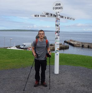
On the third day of walking I would finally arrive at the “official” start, John o’Groats…
The obligatory signpost photo
Thursday 21st July 2016
Long walk on road in morning. Highlight was view of island of Stroma. Arrived midday at John o’Groats. Changed out of boots into sandals (boots were damp inside).
Looking north to the island of Stroma
Stroma has a fascinating history. Only a century ago, hundreds of people lived on the island, yet now it is inhabited only by cattle and sheep.
Lunch at Seaview Hotel. Arran Cheese salad the only veggie option. Bought 5 postcards and wrote after lunch. Refilled water. Used toilet.
By now this was novelty: it had been two days since I had seen a toilet.
Sent text to Mum. Couldn’t update lads [on Whatsapp] – no decent Internet. Coffee and cake before heading on.
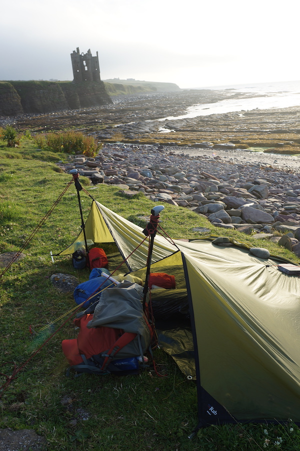
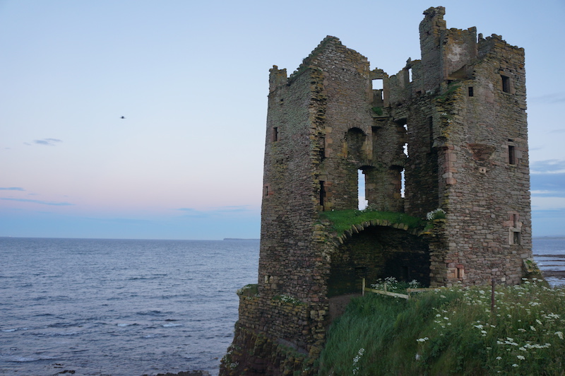
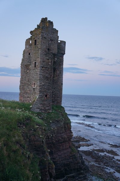
Clifftop path was fantastic, with views of Geos. After Skirza [Freswick] bay, switched to road. Stopped at Keiss by the old castle. [Made] shelter [with tarp] on the beach. Wasn’t entirely confident where high tide was. Waves were loud.
John o’Groats itself was nice enough. There’s an old hotel there, then a modern visitor area with shops and cafes. Only once I was in John o’Groats did I learn that John o’Groats was a Dutchman “Jan de Groot” who ran a ferry from this point to Orkney. His name was later Anglicised (or rather “Scoticised”).
The village of John o’Groats is known as the most north-westerly point on the British mainland, but in reality this point is at Duncansby Head 3km away, which has only a lighthouse. I walked there too – it’s far more stunning than the village.
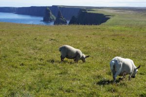
Beach near Duncansby Head“Geos” (local name for these rock features) near Duncansby Head, plus sheep.
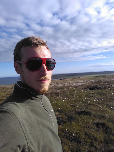
Bog selfie, a few moments after remembering I had packed sunglassesKeiss castle, after 10pm. It doesn’t get very dark in Scotland in July.Keiss Castle, side view
As I awoke on the beach at Murkle Bay on the north coast of Scotland, I still had a way to go before I would even reach my start point of John o’Groats. First I wanted to visit Dunnet Head – which includes Easter Head, the most northerly point of mainland Britain.
Looking over Murkle Bay towards Dunnet Head
Wednesday 20th July 2016
Walked on road to Castletown. Flagstone museum was shut in morning. Old boats by old flagstone works. Next along beach to Dunnet – then onto Dunnet Head. Much larger than expected. Hoped for a cafe at lighthouse, but no, so carried on. Dunnet Head – Done it! No views due to cloud.
I forgot to mention the thunder storm on the way to the lighthouse. I was fairly high up and the lightning was pretty close. I had to crouch down in a ditch for about half an hour in pouring rain to wait for it to pass.
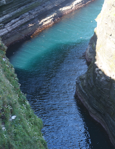
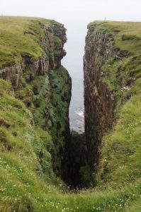
“Geo” rock feature on Dunnet Head
Long and tiring walk through clusters of housing (no shops etc).
This is when I first became conscious of where I was: Caithness. Until that point I was only aware that I was in the far north of Scotland. The historic county of Caithness, although part of Scotland, has a unique history of Norse influence – it was once a disputed territory between Norway and Scotland. The locals seem proud of their heritage and fly the flag of Caithness at least as much as the Scottish flag.
Arrived at forest I had seen on map, but struggled to get in. On my first attempt, I encountered a skeleton (presumably sheep, not person) and decided to turn back due to stream and spiky bushes. Tried field, opposite – but no decent surface. Found a way into the forest further along, slept in bug net without rain cover.
Yes you read that correctly, on only my second day of walking I discovered a skeleton. A fucking skeleton.
The forest I slept in that night was not so pleasant. Although the trees were living, the forest felt dead. The trees were so close together it was impossible to walk through without climbing over branches. Between each line of trees was a drainage ditch full of orange gunge. I slept between two such ditches. Usually when sleeping in forests I am aware of life all around, although I can’t see it. Perhaps a deer, a fox, or an owl. But this forest was silent. I later learnt that forests such as this in area were considered controversial: the land was not suited to forestry but forests were planted in the 1980s nonetheless as a result of poorly devised tax breaks. The forest did however provide me with somewhere to sleep, which would have been tricky anywhere else since the natural habitat in that area is almost entirely bog.
I set off from Chester late on the evening of Monday 18th July 2016. The plan was to catch the train up overnight to Inverness, then onto Thurso – which has the most northerly railway station in the UK. From there I planned to walk to Dunnet Head – the most northerly point of the British mainland.
For each day of my journey I will publish my journal entry – precisely one year later, so for example today is 19th July 2017 and I am publishing the journal entry for 19th July 2016. These journal entries were written either on the day shortly afterwards when the events were still fresh in my memory. I will mostly be transcribing the entries as I wrote them at the time – this will include bad grammar, but I will correct bad spelling and may add a few words where really necessary for clarification. Any other thoughts or recollections will be published below the journal entry. My first entry follows:
Tuesday 19th July 2016
I took sleeper [train] up from Crewe to Inverness: 23:56 – 8:38. I was in seated carriage – saving £90 over bunk.
I didn’t get much sleep – partly because there was a baby in the carriage who seemed to prefer crying over sleeping. However the reclining seats were fairly comfortable, an eye mask and earplugs were provided, and the atmosphere was relaxed when the baby wasn’t crying. The night didn’t seem to last long – in fact it was never truly dark. In fact the whole of the UK never experiences true night-time in mid-summer: the sun is always making its presence known, so we are really in twilight. But this becomes far more obvious further north, particularly on a clear night. Once we were in Scotland the sleeper train seemed to turn into a normal early morning service for local people, with regular stops at remote rural stations, so there was more activity in the seated carriage.
Pack is very heavy – almost 3 stone (18kg?). Should get much lighter as provisions are used. Breakfast in “So Coco” – delicious mocha and cream cheese crepe. A last taste of civilisation?
Train to Thurso: 10:38 – 14:30
Found a Veggie cafe in Thurso for a late lunch – unexpected!
Walked along shore – first cliffs until path disappeared. Then onto beach. Later had to go back onto cliffs as no beach. Finally stopped at Murkle Bay after 6 miles.
I didn’t make it to Dunnet Head as planned! My pack was really heavy and I was still recovering from my bike accident. It was already becoming clear that I would not be able to walk 25 miles a day as I had in training. It was also sunny and hot, which made walking tougher but kept my spirits up.
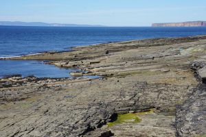
Looking back at Thurso as I walked along coast.Rock features near Thurso, with Dunnet Head (right) and Orkney Islands (left) in background.
I had the idea to walk Land’s End to John o’Groats towards the end of 2015. I had already decided it was time to move on from my job at the time, and it seemed like the perfect opportunity to go on a big adventure.
This famous route is frequently cycled, and occasionally walked. It is 603 miles as the crow flies, about 850 miles by road, and at least 1,200 for an interesting off-road route. I would be walking an off-road route.
I prepared for the walk over the first half of 2016. I bought The End to End Trail – the most recent guidebook for this route, which I planned to follow. I was hiking up to 25 miles a day on the weekends, sometimes with the Metropolitan Walkers (a London-based walking group for young-ish people), and sometimes solo. At the Metropolitan Walkers I met a couple of people who had done the walk. Their advice was invaluable – although I had a guidebook, being able to chat with someone about their experiences really helps. Meeting people who had done it was a turning point; it was no longer just some crazy idea, but it now seemed achievable and I decided I was going to do it.
I discovered that as I planned to start in summer, it was better to walk from north to south (John o‘Groats to Land’s End – “JOGLE” rather than the more traditional “LEJOG”). There were a number of reasons for this. On Scottish estates the deer stalking typically occurs in late August or September, which can mean diversions round the estates. The Scottish midges are apparently most numerous in August, so it would be best not to be walking there then – though in practice I left too late and probably was in Scotland near the peak, in late July and early August. Finally, and most importantly, it would allow every other bloke I met in Scotland to quip “It’s all downhill from here!”.
I started to practice wild camping. My first wildcamp was an absolute disaster. I tried to walk up Scarfell Pike in the Lake District one day in April. My pack was way too heavy, I was walking at a crawling pace. The rain was constant and towards the top it was a world of ice and snow. My phone (one of my navigational tools) got so wet it froze and became unusable. The paper map I had was not weather-proof and risked being destroyed every time I took it out. I made it to some peak, but in hindsight figured out it probably wasn’t the peak of Scarfell Pike (it was hard to tell in thick cloud). In any case I decided to go back down and found a spot to camp by Angel Tarn at about 470m. I managed to pitch the tent in horrific winds, but had to cover the fly sheet in rocks to ensure it would stay grounded. When I unpacked I found one of my two sleeping bags and my thermal undergarments were soaking wet, so I shivered through most of the night, as the wind roared down from the peaks above, with some gusts so strong they would squish the top of the tent down until the poles were touching me. But I survived to live another day and started to invest in some decent equipment.
I quickly realised that for a long hike I would need better equipment than is found in most of the high street stores. The main problem with high street hiking equipment is the weight. Tents, sleeping bags, sleeping mats and cooking equipment are heavy items, so it’s really important to cut down on their weight and volume. The best retailer I have found in the UK is Ultralight Outdoor Gear – this online store can list items by weight, and they tend to only stock items worth considering. Another option worth mentioning is Alpkit – this British outdoor brand tends to hit the sweet spot between weight and price: not the very lightest gear available but considerably cheaper.
Once I had invested in some decent equipment I did further wildcamps, in less hostile surroundings: often along the North Downs Way which offers some of the best hiking near London.
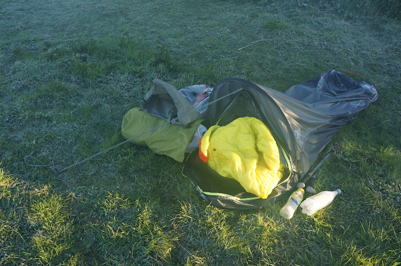
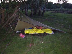
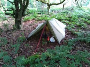
Frosty bivvy wild camp on North Downs WayWild camp with tarp in South Downs National ParkWild camp with tarp and bug net in Surrey Hills
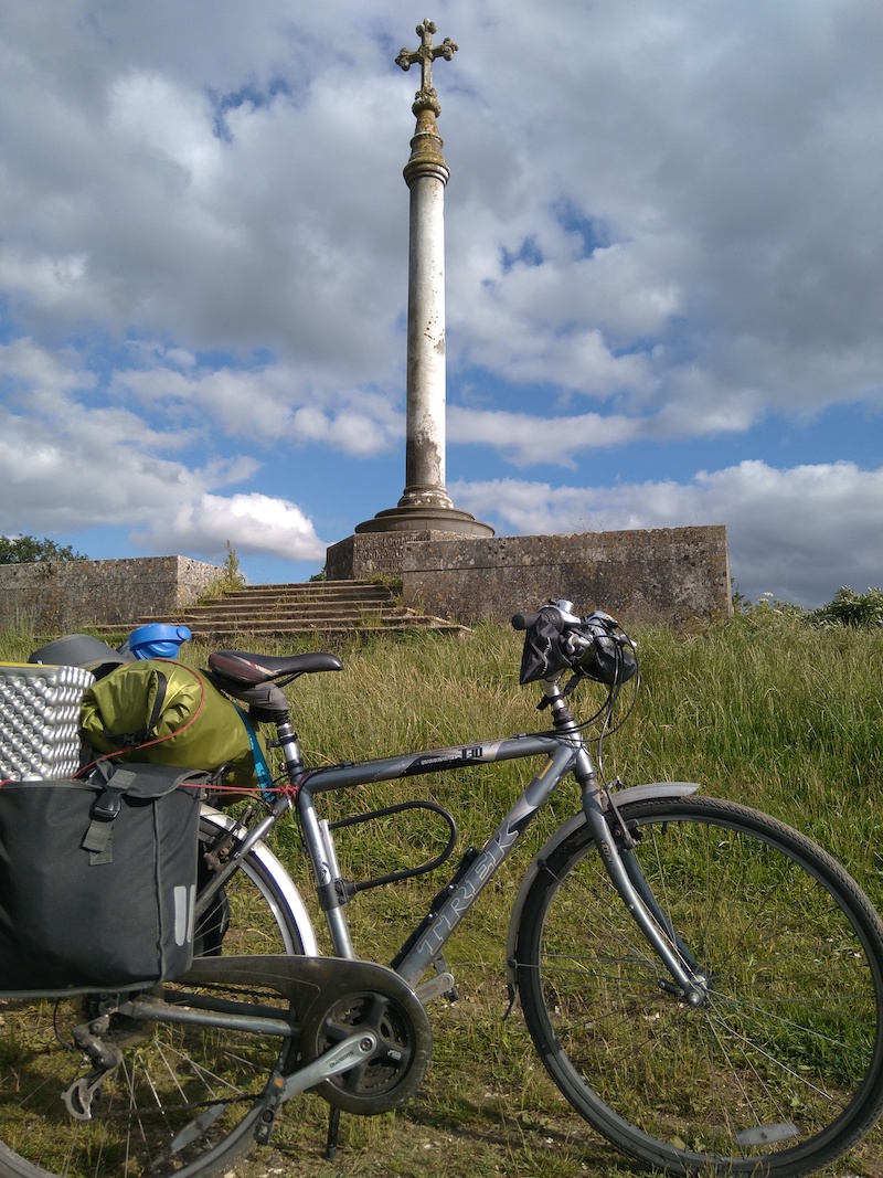
After quitting my job at the beginning of July 2016, I was almost ready to head off. But first I had the crazy idea of cycling from London to my parents’ house in Chester, whilst carrying camping equipment plus leaving gifts from my colleagues. I guesstimated that I could do this in five days. I cycled 67 miles the first day – at which point my legs stopped working and I pulled over into the forest by the road and slept. When I woke up the next morning I could barely walk. After sitting around for most of the day I managed to cycle a few miles along the Ridgeway national trail in the evening, where I slept beneath the stars by a monument to a Victorian Baron:
Pre-wild camp under memorial to Lord Wantage on the Ridgeway, Oxfordshire
The following day I was feeling better and set off early, but as I was speeding down a hill at 7am my wheels got stuck in a groove. The groove lead off the side of the path, so I was forced to either follow it into a bush or fall to the side. I fell to the side, and luckily my bike took the brunt of the fall, and lost a brake handle. In denial, I picked myself up and continued cycling in attempt prove to myself that I was not injured. I gradually became aware of all the places my body was in pain. I had a number of grazes, and a big wound in my side. I stopped and patched myself up with a first aid kit, then in survival mode I continued to cycle 11 miles into Swindon, where a nurse at the A&E department put proper dressings on my wounds. I took the train to Chester and realised the next day how much damage my body had taken. I spent a couple of weeks recovering before I was able to do any real exercise. Once I was healthy enough to run a few miles I booked a sleeper train to Scotland.
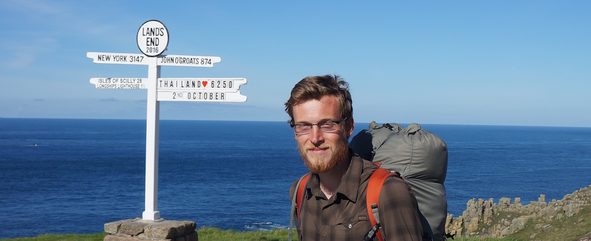
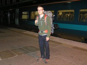
I finally set off on the evening of Monday 18th July 2016, with an 18kg pack and a bunch of dressings for my wounds, which were still not healed. My mum saw me off at the station and insisted on taking this photo:
On the platform at Chester railway station, about to board the first of three trains to Thurso in Scotland