I had one task for the day: cross over Cross Fell, which at 893m is the highest mountain in the Pennines and would be the highest point on my entire journey (excluding Ben Nevis which was an off-route optional extra). The Scottish Highlands had many taller mountains but I never crossed the peaks.
Thursday 25th August 2016
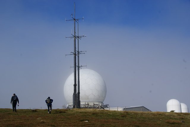
First a low stretch along river. Stopped at Post Office for coffee. Then long gradual climb up Cross Fell. Stopped in Gregs Hut (bothy) on Cross Fell to eat lunch. A good path down past a radar station / death star which appeared out of the mist.
I later found out this was Great Dun Fell Radar Station. The station has additionally been used by the University of Manchester for cloud experiments. Appropriately it was in the cloud when I saw it. I did not see it until I was very close, and it took me by surprise as I was not expecting to find such a large structure up there!
Arrived in Dufton, settled into hostel and went to The Stag Inn for a pint. This was the cheapest hostel so far – £15 with breakfast!
Distance: 20.4 miles [view on map]
Spending: £10